Develop Model Inputs
STEP 7: OBTAIN OR BUILD INPUTS TO CONNECTIVITY MODELING TOOL(S)
Outcomes or Products
Inputs to connectivity model tool(s) to be used; for most tools, this will include:
- Habitat input: Spatial data layer showing locations or areas to be connected
- Cost or resistance surface: The spatial data layer indicating difficulty or ease (cost or resistance) of movement throughout the assessment landscape
Prerequisites
STEP 3: Identify species to be assessed
STEP 4: Characterize biology, ecology of species to be assessed
STEP 6: Identify the connectivity modeling tool(s) that will be used
Description
In this step, you’ll obtain or create the geospatial layers needed as inputs for your connectivity modeling.
Skill Sets or Expertise Needed
- Expertise with geospatial data and GIS software
- Understanding of spatial modeling and its limitations
- Biological or ecological expertise in the species or systems to be assessed
How To Conduct This Step
The data needed to model connectivity will depend on 1) the species or systems in question and the features that act as barriers, impediments, or enhancements to movement, and 2) the tool(s) that is selected for modeling.
A connectivity assessment will generally require two data layers: 1) a data layer containing the areas of habitat to be connected, and 2) a data layer or surface indicating cost or resistance, indicating how easily the species can move across the landscape.
Cost Surface / Resistance Surface Cost surface and resistance surface are terms for the spatial data layer that is developed to represent the various impediments, barriers, or enhancements to species movement. The barriers or impediments will be reflected in this surface as having a higher cost of movement or greater resistance to movement, while enhancements will appear with low cost or resistance. |
Developing a Data Layer of Areas To Be Connected
The questions you are trying to answer in your assessment will inform data layers that you might use to indicate the areas to be connected. Read more...
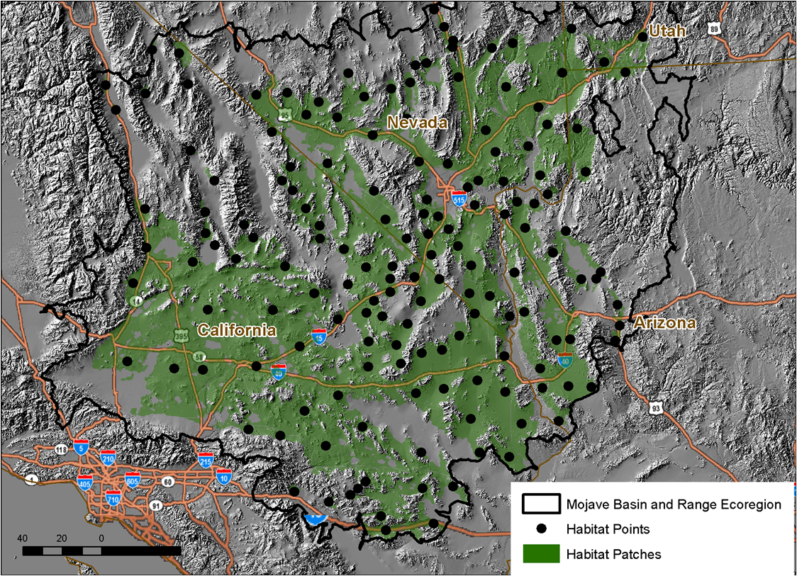
Example of habitat point locations for desert tortoise
Developing a Cost or Resistance Surface
You may be able to use an existing habitat suitability model as your cost or resistance surface, or you may need to build this data layer. Read more...
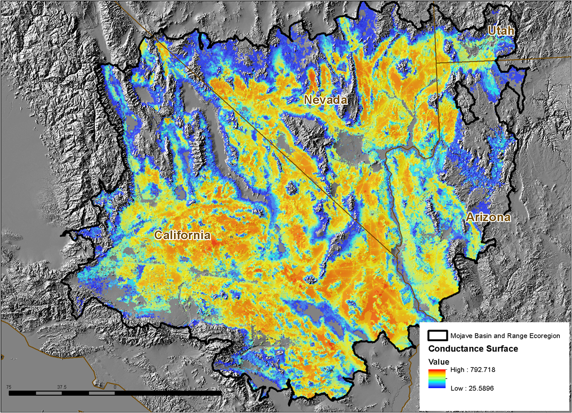
Example of a resistance surface for desert tortoise
Preparing for Optional Sensitivity Analysis
Model validation is largely addressed in the subsequent step. However, sensitivity analysis may also be a useful approach to model validation and would be conducted as part of the model runs. As you prepare data inputs, consider whether you might conduct a sensitivity analysis and need to modify model inputs accordingly. Sensitivity analysis could include, for example, adjusting cost or resistance values in the cost surfaces or running your connectivity models against different climate change projections and observing or calculating how the results differ with those changes. If very different results are obtained from relatively small changes in model parameters, then the model has a high level of sensitivity and a correspondingly lesser degree of certainty, compared to a series of model results that are relatively similar across runs with adjusted inputs.